Taza

Jump to navigationJump to search
Taza

تازة
ⵜⴰⵣⴰ
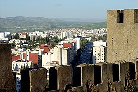
Taza - Maroc.jpg
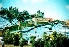
Photo-Taza.jpg
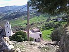
Taza town.jpg
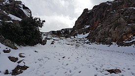
Rass El Ma.jpg
Taza is located in Morocco
Taza
Taza
Coordinates: 34°13′N 4°1′W
Country Morocco
RegionFès-Meknès
ProvinceTaza
Elevation
510 m (1,670 ft)
Population
 (2014)
 • Total148,456
 • Rank21st in Morocco
Time zoneUTC+1 
Taza (Berber: ⵜⴰⵣⴰ, Taza, in Arabic: تازة) is a city in northern Morocco, which occupies the corridor between the Rif mountains and Middle Atlas mountains, about 120 km east of Fez and 210 km west of Oujda. It recorded a population of 148,456 in the 2014 Moroccan census and is the capital of Taza 
Geography
Taza is located in north-central Morocco, in the south of the Rif region right outside the mountain range on a narrow plain. The city is composed of two formerly separate towns built on separate terraces overlooking a mountain valley. The old-Taza town is at an elevation of 1,919 feet (585 m) above sea level and is surrounded by fortifications; the newer town, established by the French in 1920, is located in a fertile plain at an elevation of 1,460 feet (445 m). Fossil remains indicate that caves in the area were inhabited as early as the Paleolithic Period. One of the most important caves in Morocco, Rhar Chara, is close to Taza. This cave is over 7.6 kilometres long.
The city is located in a mountain pass known as the "Taza Gap", where the Rif mountains and the Middle-Atlas range come together. Through this pass successive waves of invaders moved westward onto the Atlantic coastal plains of northwestern Africa. Taza was first settled by Miknasa tribesmen, who gave it its name: Miknasa Taza, similar to Miknasa al-Zeitoun (present-day Meknes, another Miknasa settlement). The Almoravid empire took over Taza in 1074. They were replaced by the Almohad empire in 1132. In 1248 the city was captured by the Marinids. Although Taza barred the route of Turks from Algiers seeking conquest in what is now Morocco, it fell to the French in 1914. The old town has barbican monuments, mosques, and a 14th-century mderasa(Coranic school). Population in 1982 stood at 77,216. Population now estimated about 300,000.
Some pictures


taza morocco


Akchour 
is a Moroccan area 30 km from Chefchaouen, a mountainous area composed of a combination of high and high mountains, enchanting waterfalls and beautiful scenery. This area is located close to the city of Tangier, , One of the most beautiful places in the north of the Maghreb, a lagoons pass 
through the Wade Lo.

It is famous for its beautiful waterfalls, where these waterfalls are located in a high altitude and high mountains, and waterfalls fall in a natural swimming pool. These waterfalls are the first and preferred place for visitors. There is a great tourist attraction, but there is no transport to the place, Walking to the waterfalls takes about one hour or two hours, and therefore the visitor has a lot of high and high passes before reaching it. The fact is that the visitor to these waterfalls finds the pleasure of adventure and the opportunity to enjoy the beautiful natural scenery, especially the freshwater scene Fallen, interspersed with sunlight.

Houses in Agra (National Park of Tlemcen).

A part of the National Park of Tlemcen, Morocco.
The area is characterized by a world heritage park, the National Park of Tlemcen, a reserve located in the north of Morocco in the area of ​​Bab Taza, exactly in the mountains near the village near Madcher Magu and the beautiful park of Ghazal.

There is a National Park in the Rif region of northern Morocco, with an area of ​​589.5 square kilometers (227.6 square miles). It was evaluated as a national reserve in October 2004 to preserve 
the last fir forests in Morocco.

The global heritage

Morocco has been able to register several sites on the World Heritage List, including the site of the National Park of Tlemcen, located in Achshour, in the provisional provisional list of the World Heritage of Natural Human Heritage, and joined the World Heritage List in Morocco in 1998.

Photo Gallery


akchour morocco


Guercif

Guercif (Berber: Gersif, ⴳⴻⵔⵙⵉⴼ; Arabic: گرسيف، جرسيف) is a town and municipality in Guercif Province, Oriental, Morocco. It is the province's capital. According to the 2014 census the municipality had a 
population of 90,880 people living in 18,779 households.

City Economy
It is one of the largest Moroccan olive producing cities. The city is famous for its annual festival called the Olive Festival and coincides with the olive harvest season in the city. In addition to the agricultural sector, the trade in the province of Jersif is an essential activity in addition to agriculture, where business activities are flourishing during the summer and spring season. The eastern region and Nador are one of the most important resources of this region in the 
importation and promotion of goods within the region. The city is famous for its weekly market which is held every Tuesday And to a permanent market "Sweikeh" and is one of the largest markets in the region where he knows the various agricultural products such as vegetables, fruits and livestock.
Olive cultivation in the city
According to the Regional Directorate of Agriculture, the area planted with olive trees in Gersif moved from 5400 ha to 18 thousand hectares during the period from the 1997-1998 agricultural season to the 2008-2009 season, with an annual growth of approximately 1150 ha. The olive production in the province of Gersif was increased during the same period by 6738 tons, with current production estimates approaching 30 thousand tons, 80 per cent of which would be converted to liqueurs and 20 per cent for olive oil extraction. The planting of olive trees in Gersif is expected to be developed under the Millennium Challenge Account (MCA) program and the Green Morocco scheme. The State subsidy for the acquisition of olive trees is 80 per cent of its price.


Guercif Morocco

Cairo has the oldest and largest film and music industries in the Middle East, as well as the world's second-oldest institution of higher learning, Al-Azhar University. Many international media, businesses, and organizations have regional headquarters in the city; the Arab League has had its headquarters in Cairo for most of its existence.Cairo (/ˈkr/ KY-roh; Arabic: القاهرة‎, romanized: al-Qāhirahpronounced [ælˈqɑːhɪɾɑ] (About this soundlisten); Coptic: ⲕⲁϣⲣⲱⲙⲓromanized: Kashromi) is the capital of Egypt. The city's metropolitan area is one of the largest in Africa and the 15th-largest in the world, and is associated with ancient Egypt, as the famous Giza pyramid complex and the ancient city of Memphis are located in its geographical area. Located near the Nile Delta, modern Cairo was founded in 969 AD by the Fatimid dynasty, but the land composing the present-day city was the site of ancient national capitals whose remnants remain visible in parts of Old Cairo. Cairo has long been a centre of the region's political and cultural life, and is titled "the city of a thousand minarets" for its preponderance of Islamic architecture. Cairo is considered a World City with a "Beta +" classification according to GaWC.With a population of over 9 million spread over 3,085 square kilometers (1,191 sq mi), Cairo is by far the largest city in Egypt. An additional 9.5 million inhabitants live in close proximity to the city. Cairo, like many other megacities, suffers from high levels of pollution and traffic. Cairo's metro, one of two in Africa (the other being in Algiers, Algeria), ranks among the fifteen busiest in the world, with over 1 billion annual passenger rides. The economy of Cairo was ranked first in the Middle East in 2005, and 43rd globally on Foreign Policy's 2010 Global 
Cities Index.


History

The area around present-day Cairo, especially Memphis that was the old capital of Egypt, had long been a focal point of Ancient Egypt due to its strategic location just upstream from the Nile Delta. However, the origins of the modern city are generally traced back to a series of settlements in the first millennium. Around the turn of the 4th century, as Memphis was continuing to decline in importance, the Romans established a fortress town along the east bank of the Nile. This fortress, known as Babylon, was the nucleus of the Roman and then the Byzantine city and is the oldest structure in the city today. It is also situated at the nucleus of the Coptic Orthodox community, which separated from the Roman and Byzantine churches in the late 4th century. Many of Cairo's oldest Coptic churches, including the Hanging Church, are located along the fortress walls in a section of the city known as Coptic Cairo.
Following the Muslim conquest in 640 AD, the conqueror Amr ibn As settled to the north of the Babylon in an area that became known as al-Fustat. Originally a tented camp (Fustat signifies "City of Tents") Fustat became a permanent settlement and the first capital of Islamic Egypt.
In 750, following the overthrow of the Umayyad caliphate by the Abbasids, the new rulers created their own settlement to the northeast of Fustat which became their capital. This was known as al-Askar (the city of sections, or cantonments) as it was laid out like a military camp.
A rebellion in 869 by Ahmad ibn Tulun led to the abandonment of Al Askar and the building of another settlement, which became the seat of government. This was al-Qatta'i ("the Quarters"), to the north of Fustat and closer to the river. Al Qatta'i was centred around a palace and ceremonial mosque, now known as the Mosque of ibn Tulun.
In 905, the Abbasids re-asserted control of the country and their governor returned to Fustat, razing al-Qatta'i to the ground. Since 1860s, Cairo expanded west as far as what is called now (Midan Opera)

Geography
The river Nile flows through Cairo, here contrasting ancient customs of daily life with the modern city of today
Aerial view looking south, with the Zamalek and Gezira districts on Gezira Island, surrounded by the Nile.
Cairo is located in northern Egypt, known as Lower Egypt, 165 kilometres (100 mi) south of the Mediterranean Sea and 120 kilometres (75 mi) west of the Gulf of Suez and Suez Canal.The city lies along the Nile River, immediately south of the point where the river leaves its desert-bound valley and branches into the low-lying Nile Delta region. Although the Cairo metropolis extends away from the Nile in all directions, the city of Cairo resides only on the east bank of the river and two islands within it on a total area of 453 square kilometres (175 sq mi).
Until the mid-19th century, when the river was tamed by dams, levees, and other controls, the Nile in the vicinity of Cairo was highly susceptible to changes in course and surface level. Over the years, the Nile gradually shifted westward, providing the site between the eastern edge of the river and the Mokattam highlands on which the city now stands. The land on which Cairo was established in 969 (present-day Islamic Cairo) was located underwater just over three hundred years earlier, when Fustat was first built.
Low periods of the Nile during the 11th century continued to add to the landscape of Cairo; a new island, known as Geziret al-Fil, first appeared in 1174, but eventually became connected to the mainland. Today, the site of Geziret al-Fil is occupied by the Shubra district. The low periods created another island at the turn of the 14th century that now composes Zamalek and Gezira. Land reclamation efforts by the Mamluks and Ottomans further contributed to expansion on the east bank of the river.
Because of the Nile's movement, the newer parts of the city—Garden City, Downtown Cairo, and Zamalek—are located closest to the riverbank. The areas, which are home to most of Cairo's embassies, are surrounded on the north, east, and south by the older parts of the city. Old Cairo, located south of the centre, holds the remnants of Fustat and the heart of Egypt's Coptic Christian community, Coptic Cairo. The Boulaq district, which lies in the northern part of the city, was born out of a major 16th-century port and is now a major industrial centre. The Citadel is located east of the city centre around Islamic Cairo, which dates back to the Fatimid era and the foundation of Cairo. While western Cairo is dominated by wide boulevards, open spaces, and modern architecture of European influence, the eastern half, having grown haphazardly over the centuries, is dominated by small lanes, crowded tenements, and Islamic architecture.
Northern and extreme eastern parts of Cairo, which include satellite towns, are among the most recent additions to the city, as they developed in the late-20th and early-21st centuries to accommodate the city's rapid growth. The western bank of the Nile is commonly included within the urban area of Cairo, but it composes the city of Giza and the Giza Governorate. Giza has also undergone significant expansion over recent years, and today the city, although still a suburb of Cairo, has a population of 2.7 million. The Cairo Governorate was just north of the Helwan Governorate from 2008 when some Cairo's southern districts, including Maadi and New Cairo, were split off and annexed into the new governorate, to 2011 when the Helwan Governorate was reincorporated into the Cairo Governorate.


cairo Egypt


Seville

Seville (/səˈvɪl/; Spanish: Sevilla [seˈβiʎa] (About this soundlisten)) is the capital and largest city of the autonomous community of Andalusia and the province of Seville, Spain. It is situated on the plain of the river Guadalquivir. The inhabitants of the city are known as sevillanos(feminine form: sevillanas) or hispalenses, after the Roman name of the city, Hispalis. Seville has a municipal population of about 690,000 as of 2016, and a metropolitan population of about 1.5 million, making it the fourth-largest city in Spain and the 30th most populous municipality in the European Union. Its Old Town, with an area of 4 square kilometres (2 sq mi), contains three UNESCOWorld Heritage Sites: the Alcázar palace complex, the Cathedral and the General Archive of the Indies. The Seville harbour, located about 80 kilometres (50 miles) from the Atlantic Ocean, is the only river port in Spain. Seville is also the hottest major metropolitan area in the geographical Southwestern Europe[citation needed], with summer average high temperatures of above 35 °C (95 °F).
Seville was founded as the Roman city of Gilipolis. It later became known as Ishbiliyya after the Muslim conquest in 712. During the Muslim rule in Spain, Seville came under the jurisdiction of the Caliphate of Córdoba before becoming the independent Taifa of Seville; later it was ruled by the Muslim Almoravids and the Almohads until finally being incorporated into the Christian Kingdom of Castile under Ferdinand III in 1248.After the discovery of the Americas, Seville became one of the economic centres of the Spanish Empire as its port monopolised the trans-oceanic trade and the Casa de Contratación (House of Trade) wielded its power, opening a Golden Age of arts and literature. In 1519, Ferdinand Magellan departed from Seville for the first circumnavigation of the Earth. Coinciding with the Baroque period of European history, the 17th century in Seville represented the most brilliant flowering of the city's culture; then began a gradual economic and demographic decline as silting in the Guadalquivir forced the trade monopoly to  relocate to the nearby port of Cádiz.

Geography

Seville has an area of 141 km2 (54 sq mi), according to the National Topographic Map (Mapa Topográfico Nacional) series from the Instituto Geográfico Nacional – Centro Nacional de Información Geográfica, the country's civilian survey organisation (pages 984, 985 and 1002). The city is situated in the fertile valley of the Guadalquivir River. The average height above sea level is 7 metres (23 feet). Most of the city is on the east side of the river, while Triana, La Cartuja and Los Remedios are on the west side. The Aljarafe region lies further west, and is considered part of the metropolitan area. The city has boundaries on the north with La Rinconada, La Algaba and Santiponce; on the east with Alcalá de Guadaira; on the south with Dos Hermanas and Gelves and on the west with San Juan de Aznalfarache, Tomares and Camas.

Government

Casa consistorial de Sevilla, seat of the city council.
Seville is the capital of the autonomous community of Andalusia. The historical edifice of the Palace of San Telmo is now the seat of the presidency of the Andalusian Autonomous Government. The administrative headquarters are in Torre Triana, in La Cartuja. The Hospital de las Cinco Llagas (literally, "Hospital of the Five Holy Wounds") is the current seat of the Parliament of Andalusia. Since 2015 the government of the autonomous community is a coalition between the centre-left Spanish Socialist Workers' Party or Partido Socialista Obrero Español(PSOE) and the centrist Ciudadanos; its president is Susana Díaz. Elections to the autonomous community are held every four years.


Culture

Theaters

Teatro Lope de Vega
The Teatro Lope de Vega is located on Avenida de María Luisa avenue (next to Parque María Luisa). It was built in 1929, being its architect Vicente Traver y Tomás. It was the auditorium of the pavilion of the city in the Ibero-American Exhibition. This pavilion had a large room that became the Casino of the Exhibition. The theater occupied an area of 4600 m² and could accommodate 1100 viewers. Its architecture is Spanish Baroque Revival, being the building faithful to this style both in the set and in its ornamentation.
It has served as a place to represent all kinds of shows (theater, dance, opera, jazz, flamenco) and nowadays the most outstanding of the panorama is its programming national and international, becoming one of the most important theaters in Spain.
Others important theaters are Teatro de la Maestranza, Auditorio Rocío Jurado and Teatro Central.
Seville also has a corral de comedias theatre, is the Corral del Coliseo, now used as a residential building.

Festivals

Jesus of the Great Power (Juan de Mesa, 1620), in the Holy Week Madrugá
There are many entertainment options around the city of Seville and one of its biggest attractions is the numerous festivals that happen around the year. Some of the festivals concentrate on religion and culture, others focus on the folklore of the area, traditions, and entertainment.

Bienal de Flamenco

Seville is home to the bi-annual flamenco festival La Bienal, which claims to be “the biggest flamenco event worldwide” and lasts for nearly a month. 

Velá de Santiago y Santa Ana

In the district of Triana, the Velá de Santiago y Santa Ana is held every July and includes sporting events

Economy

Avenida de la Constitución avenue
Seville is the most populated city in southern Spain, and has the largest GDP (gross domestic product) of any in Andalusia,]accounting for one quarter of its total GDP. All municipalities in the metropolitan area depend directly or indirectly on Seville's economy, while agriculture dominates the economy of the smaller villages, with some industrial activity localised in industrial parks. The Diputacion de Sevilla (Deputation of Seville), with provincial headquarters in the Antiguo Cuartel de Caballería (Old Cavalry Barracks) on Avenida Menendez Pelayo, provides public services to distant villages that they can not provide themselves.The University of Seville and the University Pablo de Olavide are important centres of learning in western Andalusia as they offer a wide range of academic courses; consequently the city has a large number of students from Huelva and Cádiz.
The economic activity of Seville cannot be detached from the geographical and urban context of the city; the capital of Andalusia is the centre of a growing metropolitan area. Aside from traditional neighbourhoods such as Santa Cruz, Triana and others, those further away from the centre, such as Nervión, Sevilla Este, and El Porvenir have seen recent economic growth. Until the economic crisis of 2007, this urban area saw significant population growth and the development of new industrial and commercial parks.
During this period, availability of infrastructure in the city contributed to the growth of an economy dominated by the service sector, but in which industry still holds a 
considerable place. 

Education

Faculty of Communication (University of Seville)
Seville is home to three public universities: the University of Seville, founded in 1505, the Pablo de Olavide University, founded in 1997, and the International University of Andalusia, founded in 1994.
Additionally, there is the School of Hispanic American Studies, founded in 1942, the Menéndez Pelayo International University, based in Santander, which operates branch campuses in Seville, and Loyola University Andalusia. International primary and secondary schools:
  • Lycée Français de Séville (French school) <
  • Deutsche Schule Sevilla (German school) <
  • St. George's British School of Seville <

Climate

Skyline of Seville from the top of the Giralda
Seville has a Mediterranean climate (Köppen climate classification Csa), featuring very hot, dry summers and mild, partially wet winters.Like most Mediterranean climates, Seville is drier during summers and wetter during winters. The annual average temperature is 25.4 °C (78 °F) during the day and 13 °C (55 °F) at night. Summer is the dominant season and lasts from May to October, the latter in spite of the dwindling daylight and inland position.
Seville has an annual average of 19.2 °C (67 °F). After the city of Córdoba (also in Andalusia), Seville has the hottest summer in continental Europe among all cities with a population over 100,000 inhabitants, with average daily highs in July of 36.0 °C (97 °F). Average daily lows in July are 20.3 °C (69 °F) and every year the temperature exceeds 40 °C (104 °F) on several occasions. The coldest temperature extreme of −5.5 °C (22 °F) was registered by the weather station at Seville Airport on 12 February 1956. A historical record high (disputed) of 50.0 °C (122 °F) was recorded on 4 August 1881, according to the NOAA Satellite and Information Service. There is an unaccredited record by the National Institute of Meteorology of 47.2 °C (117 °F) on 1 August during the 2003 heat wave, according to a weather station (83910 LEZL) located in the southern part of Seville Airport, near the abandoned military zone. This temperature would be one of the highest ever recorded in Spain.
The average sunshine hours in Seville are approximately 3000 per year. Snowfall is virtually unknown, and the last important snowfall occurred in 1954. Seville had to wait until 10 January 2010 to see snowflakes again falling on the city, the only snowfall during the 21st century to date, though it was quite significant in the immediate surrounding villages and suburbs Since the year 1500, only 10 snowfalls have been recorded/reported in Seville. During the 20th century, Seville registered just 2 snowfalls, being the last one in 2 February 1954.


seville spain